Rive-Sud de Montréal Folded Map
- Publisher
- MapArt Publishing Corporation
- Initial publish date
- Feb 2019
- Category
- Atlases
-
Sheet map, folded
- ISBN
- 9781554861507
- Publish Date
- Feb 2019
- List Price
- $5.95
Add it to your shelf
Where to buy it
Description
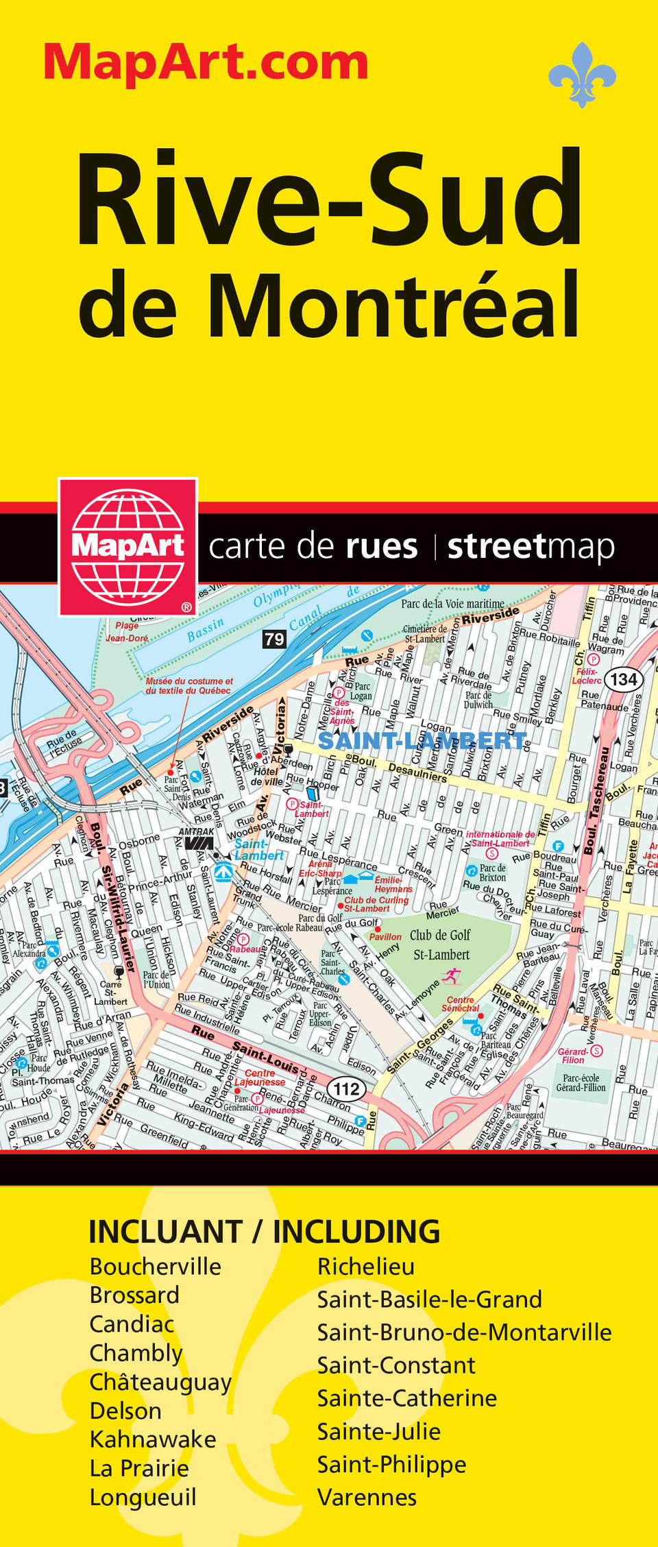
Folded maps have been the trusted standard for years, offering unbeatable accuracy and reliability at a great price. Detailed indices make for quick and easy location of destinations. It’s a must-have for anyone travelling, working and living in this area of Montréal South Shore. The folded map of Rive-Sud de Montréal includes detailed city mapping at 1:30,000 of Boucherville, Brossard, Candiac, Carignan, Chambly, Chateauguay, Delson, Kahnawake, La Prairie, Lery, Longueuil, Mercier, Saint-Bruno-de-Montarville, Saint-Mathias-sur-Richelieu, St-Basile-le-Grand, St-Constant, St-Lambert, St-Mathieu, St-Mathieu-de-Beloeil, St-Philippe, Ste-Catherine, Ste-Julie, Varennes. Includes street indexes and a legend. The detailed city map features include divided highways, major roads, secondary roads, main thoroughfares, minor streets, lanes / private streets, interchange numbers, one way streets, Trans-Canada highway, railways, Métro, exo train stations, ferries, municipal boundaries, recreation trails, parks / conservation areas, golf courses, commercial areas, cemeteries, institutional areas, industrial areas, indian reserves, national defence, hospitals, tourist information centres, police stations, fire halls, libraries, points of interest, national parks / historic sites, arenas, community / recreation centres, pools, baseball, soccer, tennis, skiing, campgrounds and schools. Proudly made in Canada!
Folded: 10.2 x 23.5 cm (4 x 9.25 inches) Unfolded: 68.6 x 99.7 cm (27 x 39.25 inches)
Provinces/Territories: Quebec


