St. John’s & Area Street Atlas
- Publisher
- MapArt Publishing Corporation
- Initial publish date
- Aug 2016
- Category
- Atlases
-
Book
- ISBN
- 9781553686514
- Publish Date
- Aug 2016
- List Price
- $15.95
Add it to your shelf
Where to buy it
Description
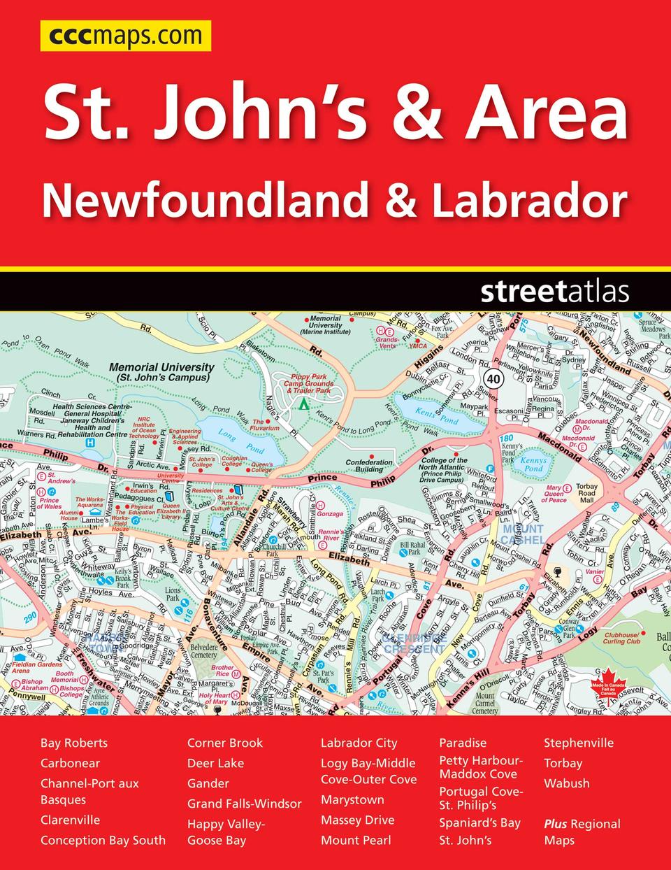
It’s the definitive auto companion for travel in this area, whether you are a resident or short-term visitor. It’s got all the features to make even the unfamiliar areas easy to navigate.
Inside this 88 page atlas you will find detailed city maps of Bay Roberts, Carbonear, Channel-Port aux Basques, Clarenville, Conception Bay South, Corner Brook, Deer Lake, Gander, Grand Falls-Windsor, Happy Valley-Goose Bay, Labrador City, Logy Bay-Middle Cove-Outer Cove, Marystown, Massey Drive, Mount Pearl, Paradise, Petty Harbour-Maddox Cove, Portugal Cove-St. Philip’s, Spaniard’s Bay, St. John’s, Stephenville, Torbay and Wabush at a scale of 1:20,000, a downtown St. John’s map (1:12,500), a St. John’s and Area map at 1:50,000, a regional map of Labrador (1:3,333,333) and a regional map of Newfoundland (1:800,000). Also included are a street index, city map legend, feature listings (points of interest, golf courses, education, hospitals, transportation), ferry information, locator maps, provincial parks and National Parks/Historic Sites listings, Atlantic Canada distance chart, community name index, The detailed city maps features include Trans-Canada Highway, divided highway, major roads, secondary roads, main thoroughfares, minor streets, lanes / private streets, interchange numbers, one way streets, street address numbers, municipal boundaries, recreation trails, parks / conservation areas, golf courses, commercial areas, cemeteries, institutional areas, industrial areas, special attraction areas, National Defence, hospitals, tourist information centres, police stations, fire halls, libraries, points of interest, liquor stores, national parks / historic sites, arenas, community / recreation centres, pools, baseball, soccer, tennis, skiing, campgrounds and public schools.
The regional map features include Trans-Canada Highway, expressways, main highways, paved and loose surface regional / major roads, paved and gravel roads, unimproved roads, distances between two points, ferries, populations, capitals, provincial boundaries, time zones, trails, national parks / historic sites, national parks, provincial parks, wilderness / protected areas, spot elevations, travel information centres, hospitals, points of interest, airports, campgrounds and skiing.
Saddlestitched
Proudly made in Canada!
21 x 28 cm (8.375 x 10.875 inches)
Provinces/Territories: Newfoundland and Labrador


