Saguenay Folded Map
- Publisher
- MapArt Publishing Corporation
- Initial publish date
- Apr 2020
- Category
- Atlases
-
Sheet map, folded
- ISBN
- 9781553689737
- Publish Date
- Apr 2020
- List Price
- $5.99
Add it to your shelf
Where to buy it
Description
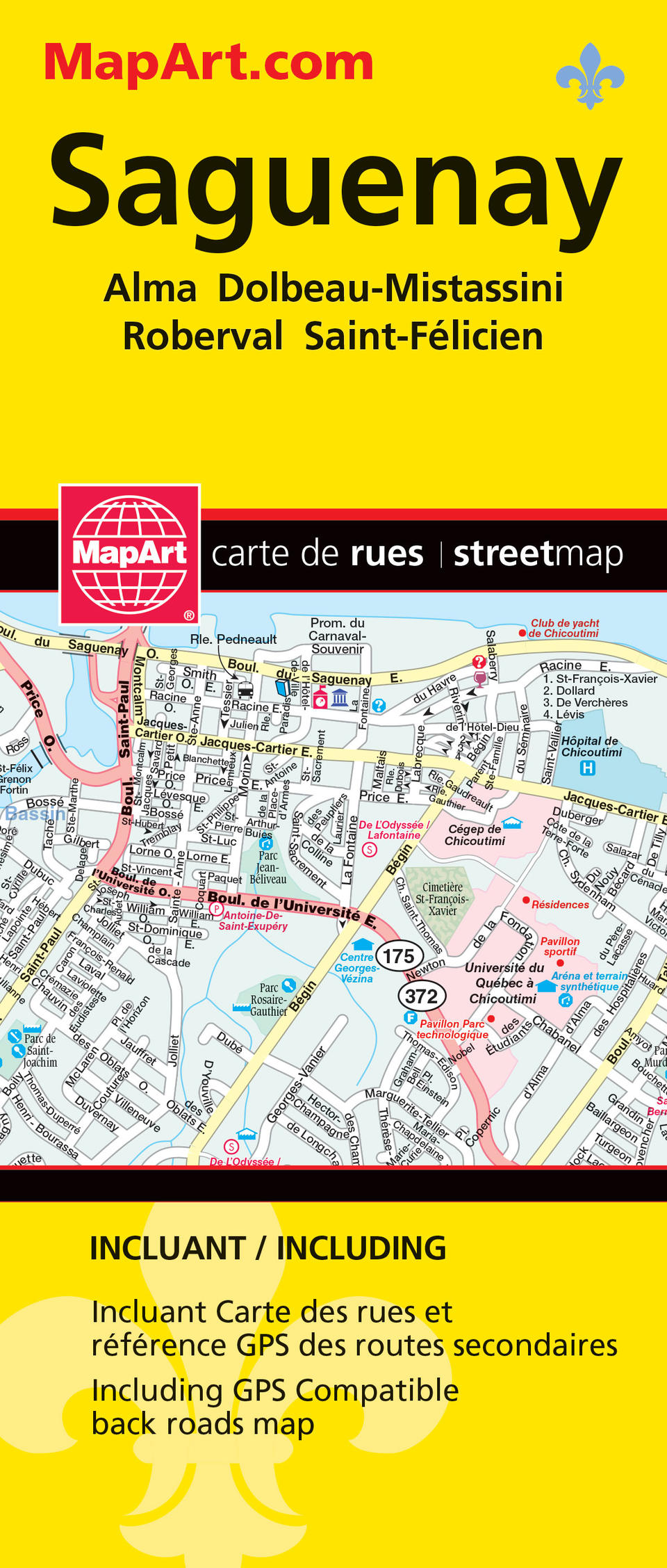
MapArt folded maps have been the trusted standard for years, offering unbeatable accuracy and reliability at a great price. Detailed indices make for quick and easy location of destinations. It’s a must-have for anyone travelling, working or living in the Saguenay area. This folded map includes detailed city maps at 1:25,000 of Alma, Dolbeau-Mistassini, Saguenay (Chicoutimi, Jonquière, La Baie), Roberval and Saint-Félicien, city map indexes, city map legend, regional back roads map at 1:270,000, regional map legend, community name index and road index.
The detailed city map features include divided highways, major roads, secondary roads, main thoroughfares, minor streets, lanes / private streets, interchange numbers, one way streets, railways / VIA Rail stations, bus stations, ferries, municipal boundaries, parks / conservation areas, golf courses, commercial areas, cemeteries, institutional areas, industrial areas, special attraction areas, hospitals, tourist information centres, police stations, fire halls, city halls, courthouses, libraries, points of interest, off leash dog parks, arenas, community / recreation centres, pools, baseball, soccer, tennis, skiing and schools.
The back road regional map features include expressways, interchanges, divided primary highways, primary highways, divided secondary highways, secondary highways, unpaved primary highways, unpaved secondary highways, feeder roads, paved and unpaved roads, unimproved roads, railways, airports, seaplane bases, Québec police, hospitals, rest areas, points of interest, camping, UNESCO World Heritage Sites, National Historic Sites, skiing, golf courses, boat launch ramps, marinas, rapids, waterfalls, peaks, lighthouses, viewpoints/lookouts, tourist information centres, municipal boundaries, regional county boundaries, tourist information boundaries, built-up areas, Indian Reserves, national parks, ZEC, protected areas, wetlands and populations. Proudly made in Canada!
Folded: 10.2 x 23.5 cm (4 x 9.25 inches) Unfolded: 68.6 x 99.7 cm (27 x 39.25 inches)
Provinces/Territories: Quebec


