Montréal Wall Map
- Publisher
- MapArt Publishing Corporation
- Initial publish date
- Jun 2019
- Category
- Atlases
-
Sheet map, rolled
- ISBN
- 9781553685913
- Publish Date
- Jun 2019
- List Price
- $49.95
Add it to your shelf
Where to buy it
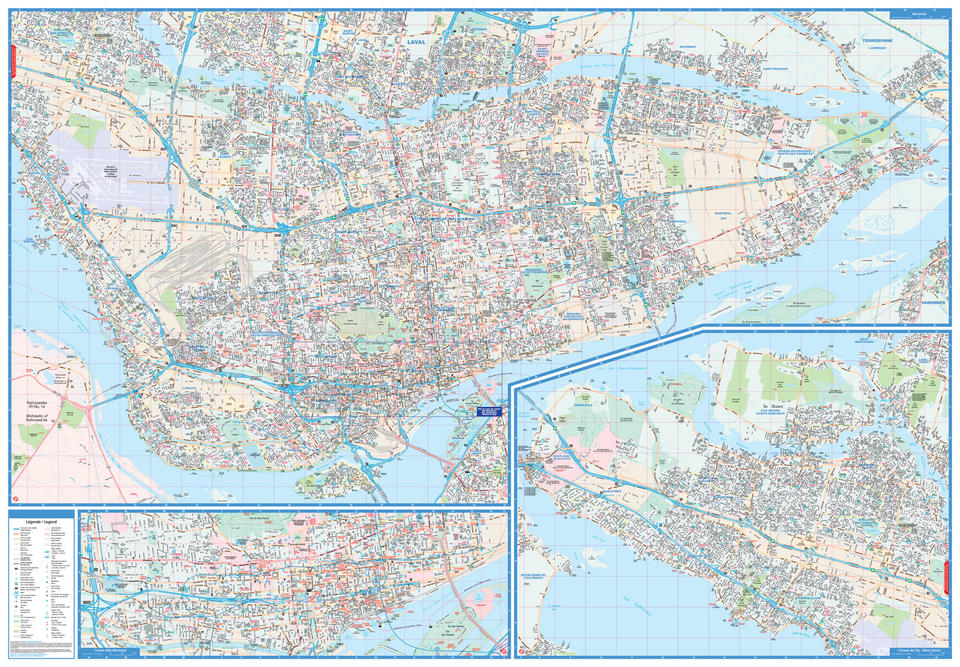
Description
Laminated wall maps are ideal for the office, home or the classroom.
This colourful laminated wall map of Montréal includes a detailed city map of Montréal and West Island both at 1:26,000, downtown Montréal map at 1:13,333 and a map legend.
The detailed city map features include divided highways, major roads, secondary roads, main thoroughfares, minor streets, lanes / private streets, pedestrian streets, bus only streets, interchange numbers, one way streets, street address numbers, Trans-Canada Highway, railways / VIA Rail stations, Métro, AMT train stations, bus stations, ferries, recreation trails, parks / conservation areas, golf courses, commercial areas, cemeteries, institutional areas, industrial areas, special attraction areas, Indian Reserves, National Defence, hospitals, tourist information centres, police stations, fire halls, libraries, points of interest, casinos, national parks / historic sites, arenas, community / recreation centres, pools, baseball, soccer, tennis, skiing, campgrounds and schools.
Proudly made in Canada!
Rolled: 4.76 x 105.4 cm (1.875 x 41.5 inches) Unrolled: 150 x 104 cm (59 x 41 inches)
Provinces/Territories: Montreal


