London Street Atlas
- Publisher
- MapArt Publishing Corporation
- Initial publish date
- Nov 2018
- Category
- Atlases
-
Book
- ISBN
- 9781553686484
- Publish Date
- Nov 2018
- List Price
- $9.95
Add it to your shelf
Where to buy it
Description
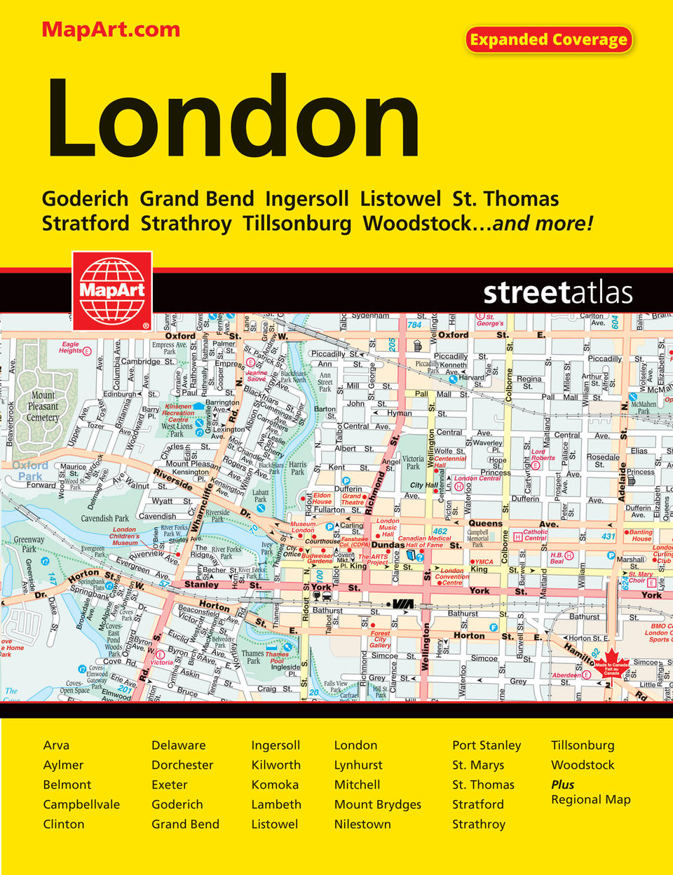
It’s the definitive auto companion for travel in this area, whether you are a resident or short-term visitor. It’s got all the features to make even the unfamiliar areas easy to navigate. Inside this 112 page atlas you will find city maps (1:20,000), regional road maps (1:250,000), locator maps, feature listings (hospitals, points of interest, golf, colleges and universities, curling) and a street index. City mapping includes Arva, Aylmer, Belmont, Campbellvale, Clinton, Delaware, Dorchester, Exeter, Goderich, Grand Bend, Ingersoll, Kilworth, Komoka, Lambeth, Listowel, London, Lynhurst, Mitchell, Mount Brydges, Nilestown, Port Stanley, St. Marys, St. Thomas, Stratford, Strathroy, Tillsonburg and Woodstock. The detailed city maps features include divided highways, major roads, secondary roads, main thoroughfares, minor streets, lanes / private streets, interchange numbers, one way streets, street address numbers, railways, VIA Rail stations, bus stations, municipal boundaries, recreation trails, parks / conservation areas, golf courses, commercial areas, cemeteries, institutional areas, industrial areas, special attraction areas, hospitals, tourist information centres, police stations, fire halls, libraries, points of interest, beer stores, liquor stores, arenas, community / recreation centres, pools, baseball, soccer, tennis, skiing, campgrounds, public and catholic schools. The back road maps features include expressways to unimproved roads, airports, hospitals, tourist information centres, OPP, rapids, waterfalls, beaches, peaks, rest areas, downhill skiing, golf, points of interest, marinas, campgrounds, viewpoints and lookouts, National Historic Sites, UNESCO World Heritage Sites, provincial parks, conservation areas, wetlands, Indian reserves, populations and more. Saddlestitched Proudly made in Canada!
21 x 28 cm (8.375 x 10.875 inches)
Provinces/Territories: Ontario


