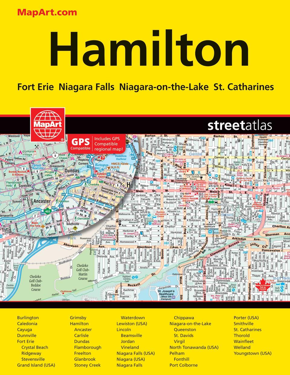
Hamilton Niagara Falls Street Atlas
- Publisher
- MapArt Publishing Corporation
- Initial publish date
- Apr 2018
- Category
- Atlases
-
Book
- ISBN
- 9781554861866
- Publish Date
- Apr 2018
- List Price
- $12.95
Add it to your shelf
Where to buy it
Description
It’s the definitive auto companion for travel in this area, whether you are a resident or short-term visitor. It’s got all the features to make even the unfamiliar areas easy to navigate. Inside this 128 page atlas you will find city maps (1:25,000), back road maps (1:250,000), locator maps, points of interest listing, wineries listing, street index and back road map road and community indexes. City mapping includes Burlington, Caledonia, Cayuga, Dunnville, Fort Erie (Crystal Beach, Ridgeway, Stevensville), Grand Island (USA), Grimsby, Hamilton (Ancaster, Carlisle, Dundas, Flamborough, Freelton, Glanbrook, Stoney Creek, Waterdown), Lewiston (USA), Lincoln (, Beamsville, Jordan, Vineland), Niagara Falls (USA), Niagara (USA), Niagara Falls (Chippawa), Niagara-on-the-Lake (Queenston, St. Davids, Virgil), North Tonawanda (USA), Pelham (Fonthill), Port Colborne, Porter (USA), Smithville, St. Catharines, Thorold, Wainfleet, Welland, Youngstown (USA). The detailed city maps features include divided highways, divided toll highways, interstate highways, major roads, secondary roads, main thoroughfares, minor streets, lanes / private streets, pedestrian streets, interchange numbers, one way streets, street address numbers, railways, VIA Rail stations, GO Train stations, bus stations, carpool parkings, border crossings, international boundaries, municipal boundaries, recreation trails, niagara escarpments, parks / conservation areas, golf courses, commercial areas, cemeteries, institutional areas, industrial areas, special attraction areas, national defences, hospitals, tourist information centres, police stations, fire halls, libraries, points of interest, beer stores, liquor stores, wineries, casinos, historic sites, arenas, community / recreation centres, pools, baseball, soccer, tennis, skiing, campgrounds, public and catholic schools. The back road maps features include expressways to seasonal roads, airports, train stations, ferries, locks, lock numbers, OPP, hospitals, customs, tourist information centres, rapids, waterfalls, beaches, peaks, rest areas, downhill skiing, wharfs, boat launches, marinas, points of interest, campgrounds, UNESCO World Heritage sites, National Historic sites, bird watching, viewpoints/looksouts, lighthouses, National and Provincial parks, conservation areas, bird sanctuaries, populations and more. Saddlestitched bound Proudly made in Canada!
21 x 28 cm (8.375 x 10.875 inches)
Provinces/Territories: Ontario


