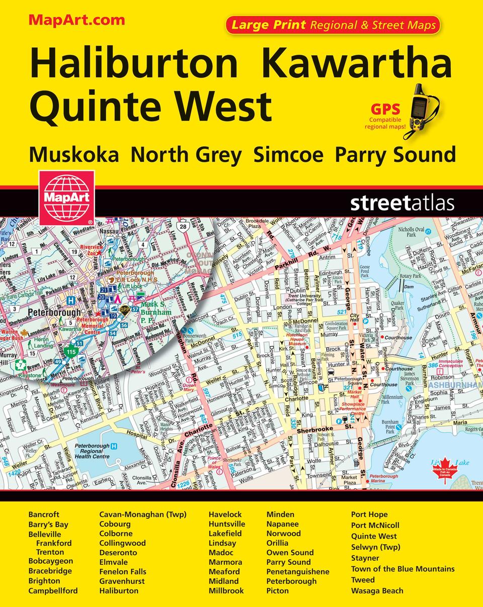
Haliburton Kawartha Quinte West Street Atlas
- Publisher
- MapArt Publishing Corporation
- Initial publish date
- Nov 2016
- Category
- Atlases
-
Book
- ISBN
- 9781554861637
- Publish Date
- Nov 2016
- List Price
- $15.95
Add it to your shelf
Where to buy it
Description
It’s the definitive auto companion for travel in this area, whether you are a resident or short-term visitor. It’s got all the features to make even the unfamiliar areas easy to navigate.
Inside this 184 page atlas you will find detailed city mapping at 1:20,000 of Bancroft, Barry’s Bay, Belleville, Bobcaygeon, Bracebridge, Brighton, Campbellford, Cavan-Monaghan (Twp), Cobourg, Colborne, Collingwood, Deseronto, Elmvale, Fenelon Falls, Gravenhurst, Haliburton, Havelock, Huntsville, Lakefield, Lindsay, Madoc, Marmora, Meaford, Midland, Millbrook, Minden, Napanee, Norwood, Orillia, Owen Sound, Parry Sound, Penetanguishene, Peterborough, Picton, Port Hope, Port McNicoll, Quinte West (Frankford, Trenton), Selwyn (Twp), Stayner, Town of the Blue Mountains, Tweed, Wasaga Beach, regional mapping at 1:250,000, locator maps, feature listings (municipal halls/civic centres, transportation, hospitals/care centres, points of interest and golf), Ontario distance chart, street index, regional road map road index and community name index, city map and regional map legends.
The detailed city map features includes highways and roads, interchange numbers, one way streets, street address numbers, railways, VIA Rail stations, bus stations, carpool parkings, municipal boundaries, recreation trails, parks / conservation areas, golf courses, commercial areas, cemeteries, institutional areas, industrial areas, special attraction areas, Indian reserves, national defence, hospitals, tourist information, police stations, fire halls, libraries, points of interest, beer stores, liquor stores, national parks / historic sites, arenas, community / recreation centres, pools, baseball, soccer, tennis, skiing / ski, campgrounds, public and catholic schools.
The detailed regional map features include expressways and roads including toll expressways, highways, roads, paved and unpaved roads, unimproved roads, seasonal roads and more. Other map features include airports, ferries, locks, lock numbers, OPP, Québec police, hospitals, customs, service centres, tourist information centres, rest areas, skiing, golf courses, wharfs, boat launch ramps, marinas, points of interest, landmarks, sugar shacks, snowmobile trails, Trans-Canada Trail, campgrounds, UNESCO world heritage sites, National historic sites, bird watching, viewpoints and lookouts, lighthouses, rapids, waterfalls, beaches, peaks, mines, greenbelts, National parks, provincial parks, conservation areas, bird sanctuaries, National Defence areas, Indian reserves, wetlands and populations and more.
Wire-O bound
Proudly made in Canada!
22 x 28 cm (8.625 x 10.875 inches)
Provinces/Territories: Ontario


