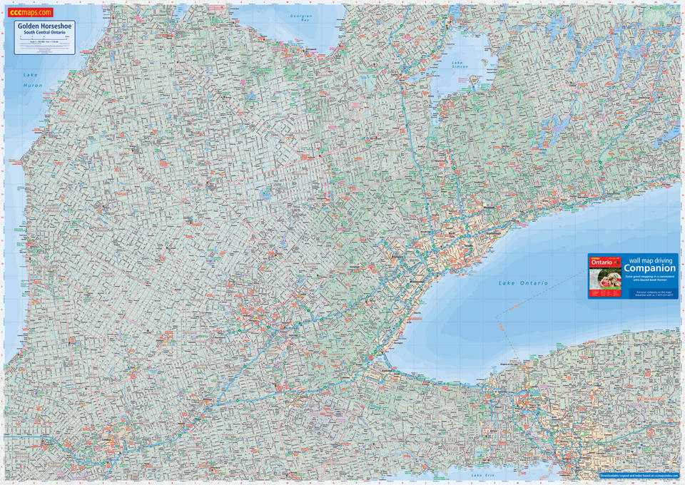
Golden Horseshoe Wall Map
- Publisher
- MapArt Publishing Corporation
- Initial publish date
- Jun 2015
- Category
- Atlases
-
Sheet map, rolled
- ISBN
- 9781554861231
- Publish Date
- Jun 2015
- List Price
- $99.95
Add it to your shelf
Where to buy it
Description
Years in the making, measuring 1.9 x 1.4 m (6.3 x 4.5 feet) this beautiful and functional wall map is the highest detailed wall map available of it’s kind.
Easy-to-read mapping at 1:155,000 scale featuring Canada’s best cartography. Unmatched map coverage, extending from Port Hope to Western New York, from Brantford to Collingwood. Heavy, durable dry erase lamination finish.
Map features include highways, unpaved roads, seasonal roads, OPP and RCMP locations, airports, railways, provincial parks, lakes and much more!
Proudly made in Canada!
Rolled: 4.76 x 135.89 cm (1.875 x 53.5 inches) Unrolled: 1.9 x 1.4 metres (6.3 x 4.5 feet)
Provinces/Territories: Ontario


