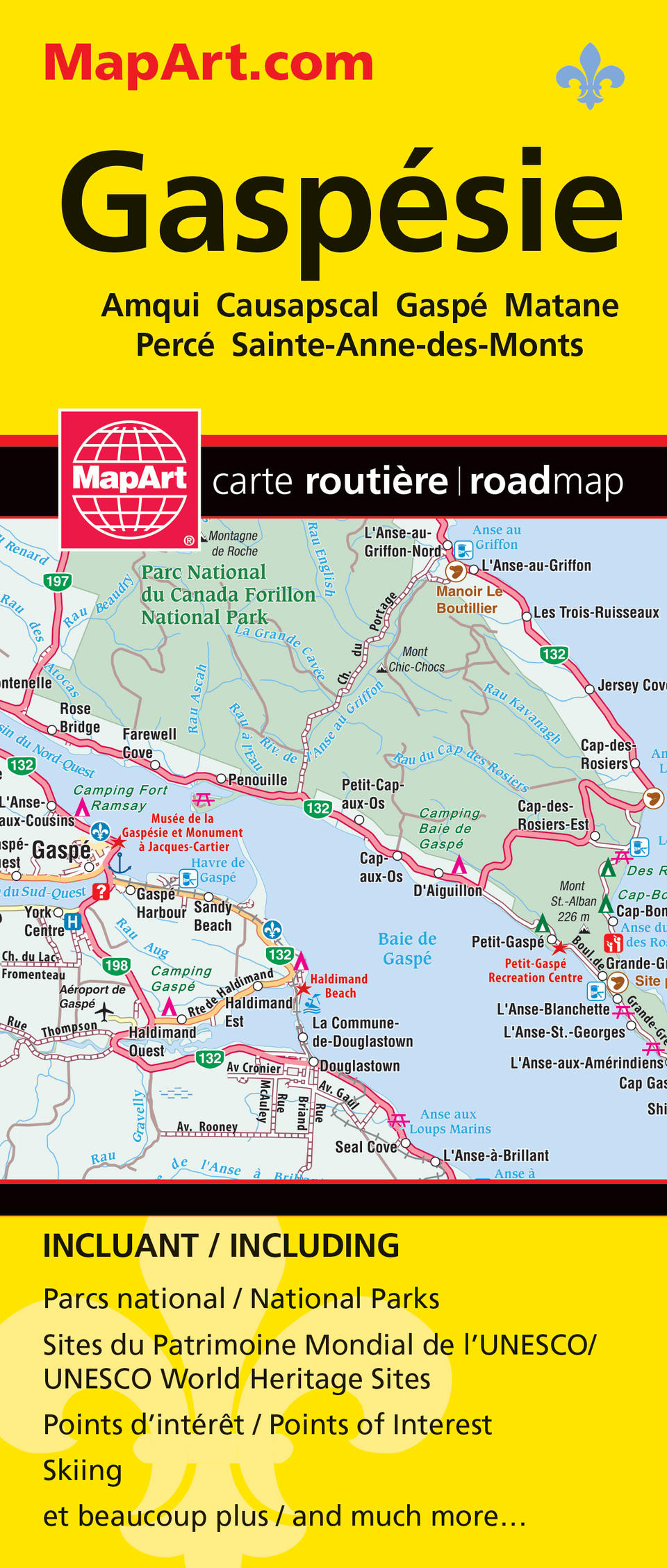
Gaspésie Folded Map
- Publisher
- MapArt Publishing Corporation
- Initial publish date
- Jul 2019
- Category
- Atlases
-
Sheet map, folded
- ISBN
- 9781554861798
- Publish Date
- Jul 2019
- List Price
- $5.99
Add it to your shelf
Where to buy it
Description
Folded maps have been the trusted standard for years, offering unbeatable accuracy and reliability at a great price. Detailed indices make for quick and easy location of destinations. It’s a must-have for anyone travelling, working and living in this area of Québec province. The folded map of Gaspésie includes detailed city maps at 1:25,000 of Amqui, Causapscal, Gaspé, Matane, Percé, Saint-Anne-des-Monts, street indexes of each community, city map legend, a regional map at 1:250,000, community index, road index, regional map legend and a map of Québec province at 1:10,000,000. The detailed city map features include major roads, secondary roads, main thoroughfares, minor streets, lanes / private streets, one way streets, railways, VIA Rail stations, ferries, recreation trails, parks / conservation areas, golf courses, commercial areas, cemeteries, institutional areas, industrial areas, special attraction areas, hospitals, tourist information centres, police stations, fire halls, libraries, points of interest, liquor stores, arenas, community / recreation centres, pools, baseball, soccer, tennis, skiing, campgrounds and schools. The detailed regional map features include expressways, interchanges, paved and unpaved primary highways, paved and unpaved secondary highways, feeder roads, paved and unpaved roads, international and provincial boundaries, airports, railways, ferries, Québec Police, hospitals, campgrounds, UNESCO World Heritage sites, National Historic sites, points of interest, rest areas, skiing, golf courses, boat launch ramps, marinas, rapids, waterfalls, beaches, peaks, tourist information centres, viewpoints/lookouts, lighthouses, bird sanctuaries, sugar shacks, municipal boundaries, regional county boundaries, tourist region boundaries, national parks, ZEC controlled exploitation zones, protected areas, wetlands, Indian reserves, populations and more. Proudly made in Canada!
Folded: 10.2 x 23.5 cm (4 x 9.25 inches) Unfolded: 68.6 x 99.7 cm (27 x 39.25 inches)
Provinces/Territories: Quebec


