Cape Breton Island Folded Map
- Publisher
- MapArt Publishing Corporation
- Initial publish date
- Jan 2020
- Category
- Atlases
-
Sheet map, folded
- ISBN
- 9781553683094
- Publish Date
- Jan 2020
- List Price
- $5.95
Add it to your shelf
Where to buy it
Description
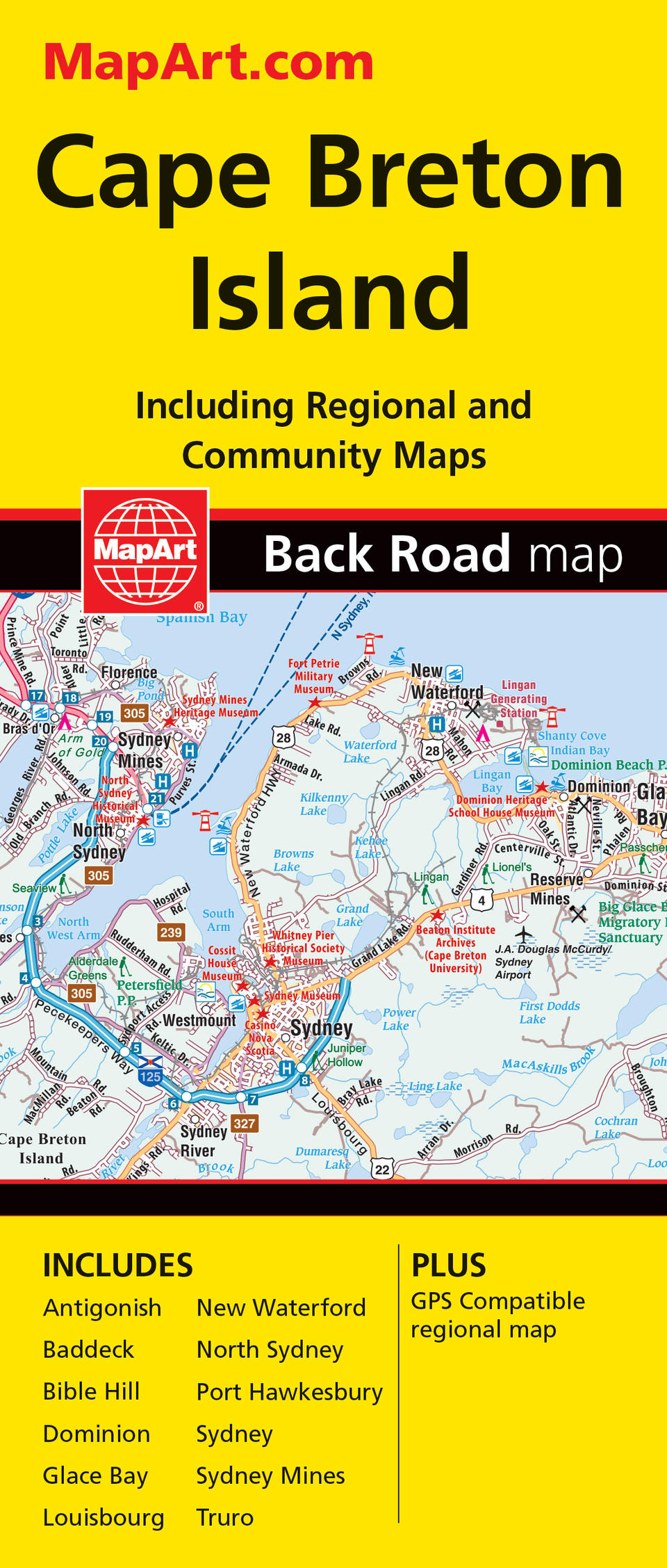
MapArt folded maps have been the trusted standard for years, offering unbeatable accuracy and reliability at a great price. Detailed indices make for quick and easy location of destinations. It’s a must-have for anyone travelling, working or living in Cape Breton Island. The Cape Breton Island / Sydney Truro folded map includes a detailed regional road map of Cape Breton Island at 1:275,000, city maps at a scale of 1:25,000 of Antigonish, Baddeck, Bible Hill, Dominion, Glace Bay, Louisbourg, New Waterford, North Sydney, Port Hawkesbury, Sydney, Sydney Mines and Truro. Indexes, distance chart and legends for the regional map and city maps are handy references. The detailed city mapping has many features such as Trans-Canada highway, divided highways, major roads, secondary roads, main thoroughfares, minor streets, lanes / private streets, one way streets, interchange numbers, railways, VIA Rail stations, bus stations, ferries, parks / conservation areas, golf courses, commercial areas, cemeteries, special attraction areas, institutional areas, industrial areas, National Defence, Indian reserves, hospitals, municipal boundaries, points of interest, national parks / historic sites, police, fire, tourist information centres, liquor stores, libraries, arenas, baseball, soccer, tennis, pools, recreation trails and public schools The regional map features include expressways, interchanges, primary highways, secondary highways, unpaved highways, paved and unpaved roads, unimproved roads, seasonal roads, airports, railways, ferries, locks, RCMP, hospitals, customs, tourist information centres, rapids, waterfalls, beaches, peaks, rest areas, skiing, golf courses, wharfs, boat launches, marinas, whale watching, points of interest, landmarks, campgrounds, UNESCO World Heritage sites, National Historic sites, bird watching, viewpoints/lookouts, lighthouses, bird sanctuaries, national parks, provincial parks, protected areas, Indian reserves, populations and more. Proudly made in Canada!
Folded: 10.2 x 23.5 cm (4 x 9.25 inches) Unfolded: 68.6 x 99.7 cm (27 x 39.25 inches)
Provinces/Territories: Nova Scotia


