British Columbia Wall Map
- Publisher
- MapArt Publishing Corporation
- Initial publish date
- Sep 2021
- Category
- Atlases
-
Sheet map, rolled
- ISBN
- 9781554862122
- Publish Date
- Sep 2021
- List Price
- $29.95
Add it to your shelf
Where to buy it
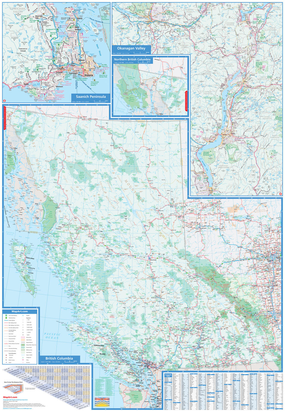
Description
Laminated wall maps are ideal for the office, home or the classroom.
Colourful, large scale, easy-to-read, laminated wall map of British Columbia includes a provincial map of British Columbia at a scale of 1:1,627,400, provincial map legend, community name index, regional maps of Okanagan Valley (1:266,800), Saanich Peninsula (1:182,600) and a distance chart.
The provincial map features include Trans-Canada Highway, Yellowhead Route, divided highways, paved and loose surface main highways, paved and loose surface secondary highways, paved and loose surface roads, unimproved roads, seasonal roads, distances between two points, ferries, international boundaries, provincial boundaries, travel information centres, border crossings, airports, hospitals, populations, capitals, built up areas, Indian Reserves, National Defence, national parks / historic sites, provincial parks, wilderness areas, forest reserves, glaciers / icefields, campgrounds, skiing and rest areas.
Dimensions: 85 x 123 cm (33.5 x 48.5 inches)
Proudly made in Canada!
Provinces/Territories: British Columbia


