Atlantic Canada Wall Map
- Publisher
- MapArt Publishing Corporation
- Initial publish date
- Dec 2018
- Category
- Atlases
-
Sheet map, rolled
- ISBN
- 9781554861965
- Publish Date
- Dec 2018
- List Price
- $49.95
Add it to your shelf
Where to buy it
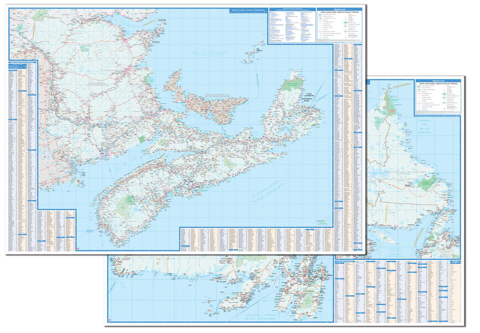
Description
Laminated wall maps are ideal for the office, home or the classroom.
Colourful, large scale, easy-to-read, double-sided laminated wall map of Atlantic Canada includes provincial maps of Atlantic Canada (New Brunswick, Nova Scotia, Prince Edward Island) on one side at a scale of 1:540,000 and Newfoundland (1:563,000) and Labrador (1:1,946,000) on the other side. Also included a community name indexes, map legends and a ferry information listing.
The provincial map features include multi-lane highways, toll highways, Trans-Canada Highway, highways, secondary highways, local roads, unpaved roads, unimproved roads, ferries, accumulated distances, airports, border crossings, hospitals, populations, capitals, national parks, national historic sites, provincial parks, campgrounds, downhill skiing, wilderness reserves, rest areas, and visitor information (provincial) centres.
Proudly made in Canada!
Rolled: 4.76 x 105.4 cm (1.875 x 41.5 inches) Unrolled: 150 x 104 cm (59 x 41 inches)
Provinces/Territories: New Brunswick, Nova Scotia, Prince Edward Island, Newfoundland and Labrador


