Journey Through Time
Places of Geological Significance in New Brunswick and Prince Edward Island
- Publisher
- Nimbus Publishing
- Initial publish date
- May 2022
- Category
- Atlases
-
Sheet map, folded
- ISBN
- 9781987894110
- Publish Date
- May 2022
- List Price
- $8.95
Add it to your shelf
Where to buy it
Description
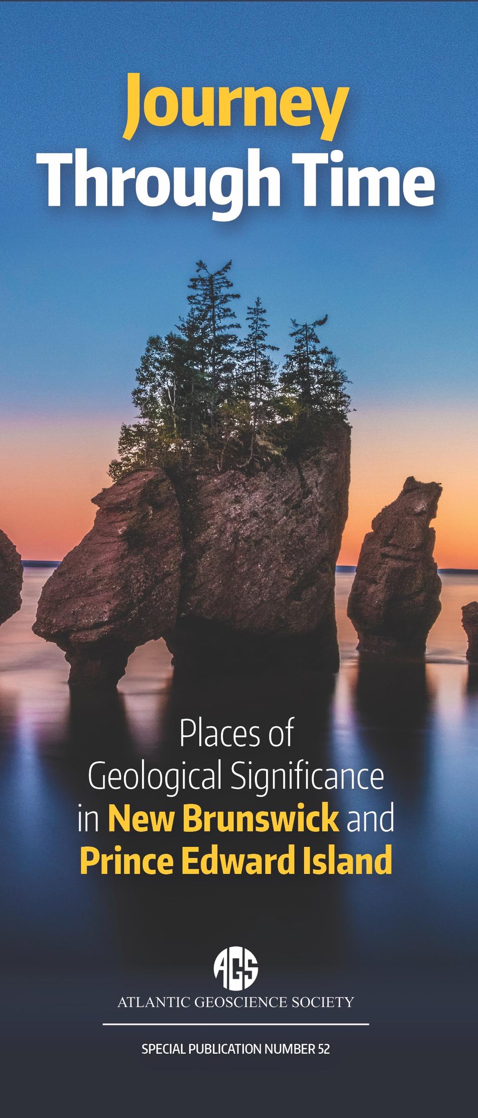
A full-colour folding map exploring the geological highlights of New Brunswick and PEI.
This detailed, full-colour, double-sided folding map features 90 geological highlights of New Brunswick and Prince Edward Island, from fractured igneous rocks at Sugarloaf Mountain, lithic sandstone at Kings Landing, massive sea stacks at Hopewell Rocks, to the coastal geology of North Cape and the impressive parabolic dune system at Greenwich.
Each site is accompanied by a short description with parking and outcrop coordinates. The detailed map depicts geological groupings and a more generalized map demonstrates colour-coded tectonic zones and cover sequences. The map side also features a detailed geological timeline. Information panels on the region's geological history, minerals, fossils, and national parks are included on the reverse.
This project is a joint publication of the Atlantic Geoscience Society and the New Brunswick Department of Natural Resources and Energy Development.
About the author
The Atlantic Geoscience Society (AGS) brings together earth scientists from universities, government institutions, and the mining, petroleum, and offshore exploration industries in the Atlantic Provinces. Its membership includes professional geologists, students, and interested members of the public. The primary goal of the Atlantic Geoscience Society is communication of ideas and information about the Earth and earth science to both the professional geoscience community and the general public.