Description
A landmark reference on a vast and historic area.
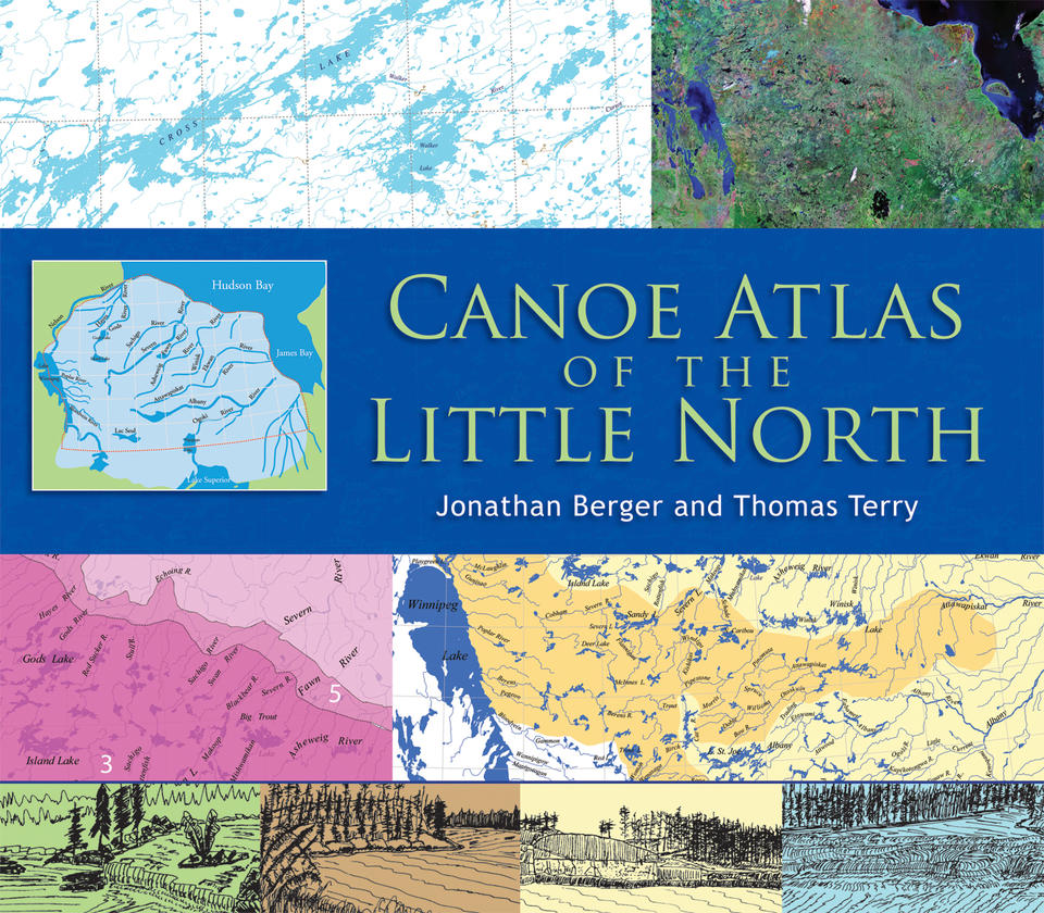
First Nations people call it Nishwawbe-Aski, "Land of the Original People." The area known as the Little North lies in Ontario and Manitoba, north of Lake Superior, east of Lake Winnipeg, west of James Bay and south of Hudson Bay. Early French fur traders referred to it as Le Petit Nord, as distinguished from the vast area west and north of Lake Winnipeg, Le Grand Nord. Despite its name, the Little North encompasses over 20 major lake and river systems within more than 500,000 square miles.
This remarkable atlas, in an oversize format, is a landmark publication -- the result of five decades of travel, research and documentation. Its first section provides an overview of the region's geography, the nature of its canoe routes, and the influence of natural and cultural history on those routes. Its second, larger section features annotated versions of 50 topographic maps derived from the well-known Canadian National Topographic System and constructed in digital form by the Geographic Information Science Center at the University of California, Berkeley. Annotations include points of interest, portages, rapids and difficult passages.
This atlas is sure to be treasured by canoeists everywhere and by anyone fascinated by the history of the North.
About the authors
Editorial Reviews
This annotated collection of 50 topographical maps and canoe routes covers more than 1.3 million square kilometres of land and waterways in Manitoba and Ontario, providing detailed information about one of the last remaining great wilderness areas of North America. Little North, the area referred to as Le Petit Nord by early fur traders, lies north of Lake Superior, east of Lake Winnipeg and south of Hudson Bay, and encompasses more than twenty major lake and river systems -- a wealth of potential exploration for paddlers. The atlas is a large, hardcover book, designed to be used at home as an aid to planning a trip, rather than a take-along field guide. Leafing through its pages, you will be amazed at how much water there is in this area, and how endless are the possibilities for expeditions. Each map (scale of 1:427,807) is matched with a page of text outlining routes, portages, rapids, etc., and giving advice about hazards, possible campsites and other useful information. The maps are prefaced by general geological, botanical and cultural information about the area. The Canoe Atlas of the Little North would be a great gift for anyone who has aspirations to explore this vast and beautiful landscape.
Coast and Kayak Magazine
This is one book that a dedicated wilderness canoeist will find hard to put down.... This is an impressive, truly wonderful book of very high production quality. Obviously not one to take along on a canoe trip, but a treasure to study at home at great leisure, dreaming of wonderful canoe trips to far-away places.
Nastawgan
Rarely does a book come along that reinvents the canoe-routes book..... The Canoe Atlas of the Little North has does it now through the sheer breadth and depth of the information collected, the effort that went into presentation, and the staggering ambirion of mapping routes over an area larger than most of the world's countries.... This is more than a canoe-route planner, this is a dreamer's book for those long, chilly winter evenings when your imagination drifts north, and you are looking for comfort in a faraway place where you want to drop your canoe and paddle around the next point.
Ottertooth.com